Periklis Dimou

Surveying Engineer, AUTh

Creating

ABOUT

Who I am:

I’m Periklis, a Surveying Engineer from the Aristotle University of Thessaloniki, specializing in cartography.
I create maps that blend accuracy and aesthetics, empowering Municipalities, Regions, and other professionals to visualize the world around them using modern tools.

My Philosophy:

For me, cartography is both an art and a science. Every project I undertake presents a unique challenge to create maps that are not only functional but also visually appealing.

Objective:

My goal is to deliver customized cartographic solutions tailored to each client’s needs, with a strong focus on quality and detail.

Skills

ArcGIS

QGIS

AutoCAD

Agisoft Metashape

RealityCapture

Adobe Illustrator

Certificate Drone Pilot

Services

PROJECTS

Development of a Pedestrian Navigation System for the Municipality of Ioannina


This system includes a detailed map of the area, providing time and distance information to the most important attractions. It also offers insights into key monuments, museums, and sights in the city of Ioannina.

For each attraction, a QR code is provided to guide users to their route via Google Maps.

The system was designed to enhance the visitors’ experience by facilitating easy exploration with user-friendly navigation and information about the most significant places of interest.

Design and Placement of Information Signs for the Most Important Stone Bridges of Epirus


Each sign provides historical data and information about the bridges, along with a map showing the area and the location of each bridge.

These signs offer visitors the opportunity to learn about the history of the bridges and appreciate their significance as valuable cultural heritage sites.

A cultural project dedicated to documenting and promoting the history of Ioannina’s iconic buildings.

Through texts, timelines, and visual material, the project highlights the architectural significance and role of these buildings as symbols of the city’s historical identity. Its aim is to preserve cultural heritage and bridge the past with the present.

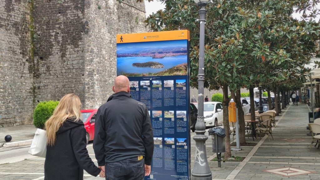
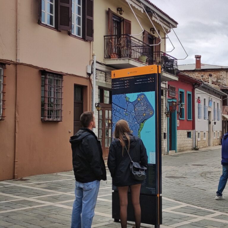
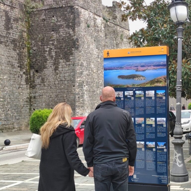
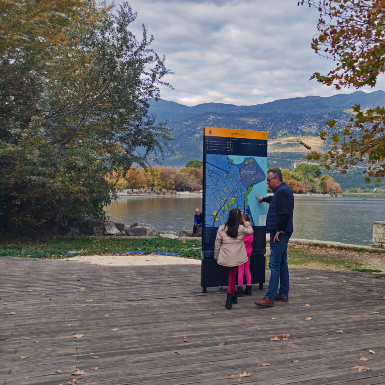
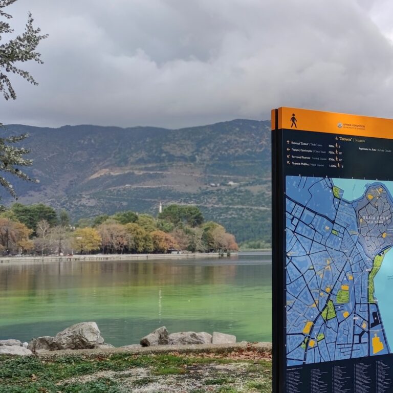
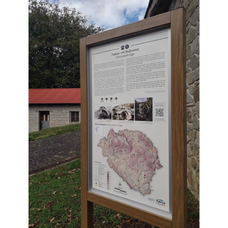
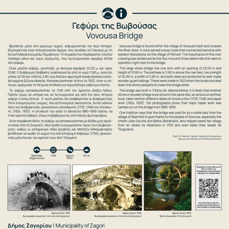
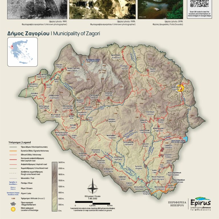
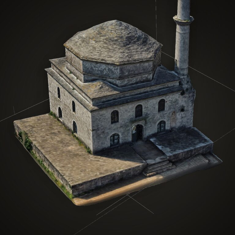
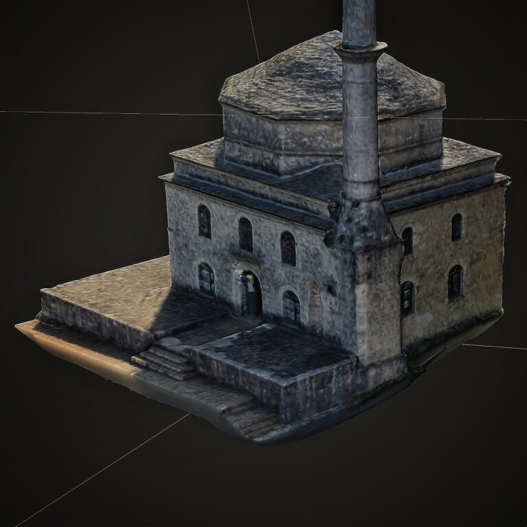
Three-dimensional mapping and modeling of monuments
 
Using photogrammetry and a combination of aerial and ground imaging, the details of buildings and structures are captured with utmost accuracy, resulting in high-quality 3D models. The goal is to preserve architectural heritage and create interactive tools for educational and cultural purposes.

Creation of Maps for the Book ‘Vikos – Aoos UNESCO Global Geopark’

Collaboration Network

CONTACT

Email

info@maplab.gr

Whatsapp

+30 695 766 5346

© maplab.gr All rigths reserved